All warnings for Basel-City
No active warnings Alert level dark green:
Active weather notice Alert level yellow:
Severe weather watch Alert level orange:
Severe weather warning (moderate) Alert level red:
Severe weather warning (heavy) Alert level violet:
Severe weather warning (extreme)
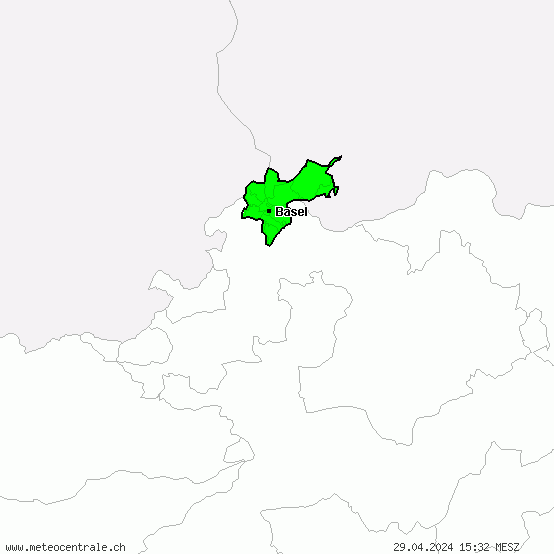
The general map contains a summary of all the severe weather hazards respectively severe weather warnings as well as useful weather advices for Basel-City. On the map you can see at which locations respectively in which areas of Basel-City severe weather events as gale/storm, heavy rain, heavy snow, thunderstorm or freezing rain are imminent. Furthermore, the overview indicates where in Basel-City extreme temperatures or icy roads / glazed frost have to be reckoned with.
We distinguish between weather watches and weather warnings. Severe weather watches are issued up to 48 hours in advance, if the occurrence of a severe weather event is probable but there are uncertainties about duration, intensity and/or the course of this severe weather event. Severe weather warnings are released if meteorologists are certain about the occurrence of the severe weather event. Thereby, three levels are distinguished: The orange warning level stands for a (upcoming) moderate severe weather event, the red warning level for a strong severe weather event and the violet, top warning level for an extremely strong severe weather event in Basel-City. The professional and experienced meteorologists at the Severe Weather Centre continually adjust the severe weather forecasts manually and make them reliable and cutting-edge round the clock (24 hours a day, 365 days a year).

